The Shoal Pond route in New Hampshire is a mellow alternative to the busier White Mountains. This loop hike is 21 miles and can be hiked in two days.
Region: New England (White Mountain National Forest, New Hampshire)
Distance: ~21 miles (2 days)
Physical Difficulty: Easy
- Only one moderate climb out of Crawford Notch (1.6 miles, 1,200 feet elevation gain)
- Mild terrain
- Trail is well maintained
Logistical Difficulty: Moderate
- Loop hike, no fee to park
- Requires moderate navigation skills, limited trail markers
- Camping regulations vary; one maintained campsite
- Eight water crossings, including one river crossing (East Branch of the Pemigewasset River)
Season: Summer, Fall
Elevation (average): ~2,000 feet
Total Elevation Gain: 3,000 feet
How to Get to the Ethan Pond Trailhead
Nearest Towns: Lincoln, New Hampshire (39 miles); Conway, New Hampshire (27 miles)
This loop begins and ends at the Ethan Pond Trailhead in Crawford Notch, on the Appalachian Trail.
There are a small handful of shuttle services to the trailhead. Ali’s Rides (603) 348-3914 and Priority Transportation (603) 631-6242 are noted as reliable for rides. There is no cell phone service at the trailhead and service is sporadic while on trail, so plan ahead for rides. The Appalachian Mountain Club also runs a hiker shuttle that stops in Lincoln and at the Webster Cliff Trail on Route 302, across from the Ethan Pond Trail trailhead.
Concord Coach Lines offers rides from Boston to Lincoln (130 miles).
Hiking the Shoal Pond Loop

The Shoal Pond Loop will take you through the heart of the Pemigewasset Wilderness, past old logging campsites, and test your navigation skills on the minimally maintained Shoal Pond Trail. What makes this loop so unique is the history behind the trails. Shoal Pond Trail, Wilderness Trail, and Thoreau Falls Trail were all once railroads leading to the J.E. Henry and Son’s logging operations. What these trails lack in grooming, they make up for in historical significance, and there are several spots along the trails where historical artifacts are located.
The Shoal Pond Loop starts on Ethan Pond Trail in Crawford Notch. The first 1.6 miles are the toughest part of the hike in terms of elevation gain (1,200 feet in 1.3 miles), but once you reach the junction with Willey Range Trail the climbing begins to level off. Ethan Pond Trail is part of the Appalachian Trail and is easily navigable, although in wetter weather the bog bridges can be slippery and small pools of water do form along the trail due to its close vicinity to Ethan Pond.
The three-mile stretch along Ethan Pond after climbing out of Crawford Notch takes you along the North Fork of the Pemigewasset River and right up along the boggy lands surrounding Ethan Pond (a popular fishing spot with native trout). There is a designated shelter and tentsites located on the .1-mile spur path leading to Ethan Pond. After passing Ethan Pond spur, the trail continues on a mainly level grade until reaching the junction with Shoal Pond Trail.
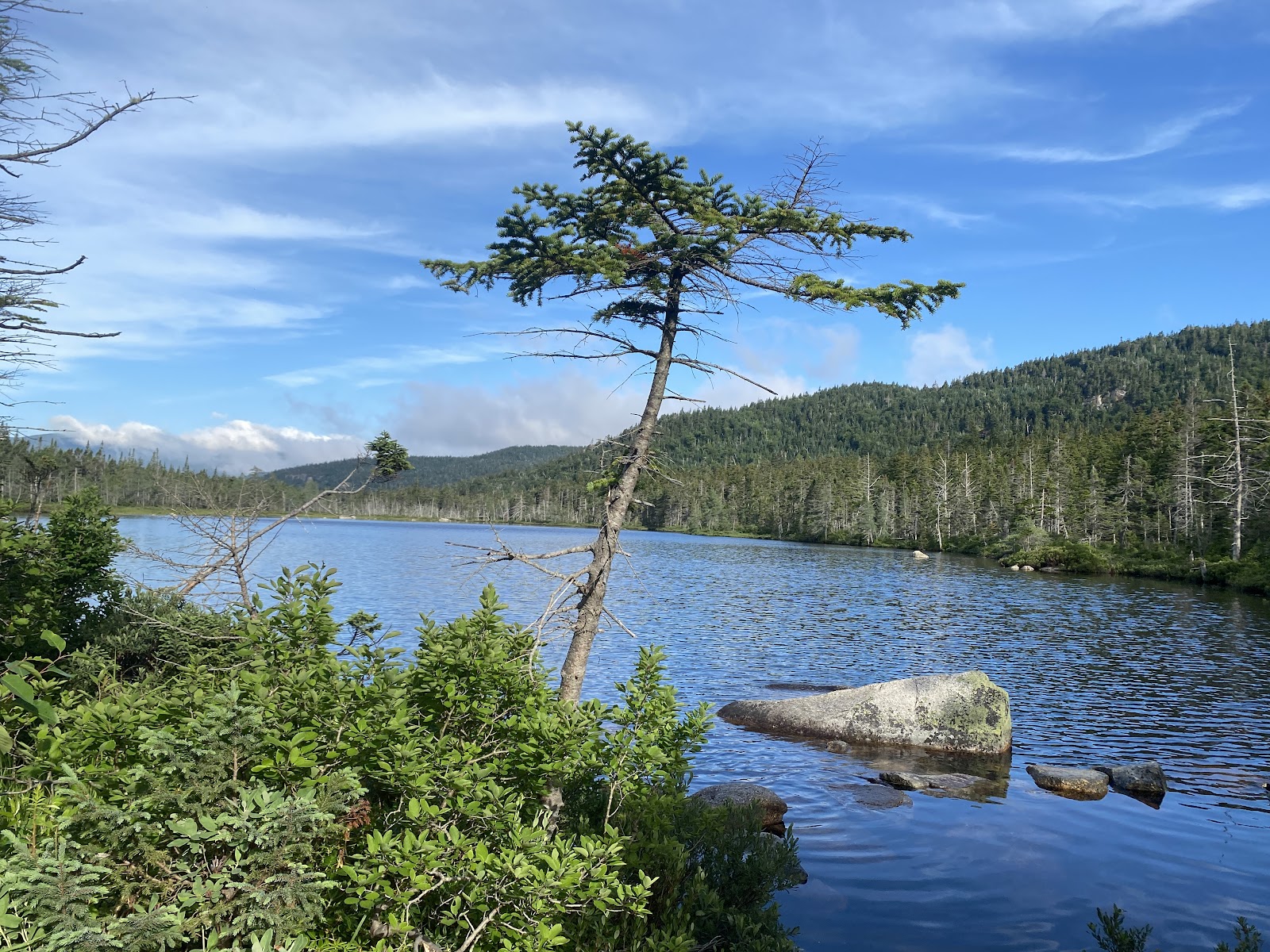
Shoal Pond Trail is the toughest section of this hike due to the conditions of the trail itself. As soon as you step past the Pemigewasset Wilderness sign, the conditions deteriorate significantly. Bog bridges that are seldom used lead the way through the overgrown brush and taller grasses that flank the trail. Not far past the junction with Ethan Pond Trail, another pond appears through the trees to the right. Shoal Pond is another pond that has native trout in it, however it is less popular for fishing due to the marshiness of the land surrounding the pond.
As the trail continues along Shoal Pond Brook and deeper into the wilderness, the conditions deteriorate more. Although it may appear to be an easy 4-mile walk when glancing at the elevation profile, what makes this trail more difficult is how marshy it can be, added onto the minimal grooming that is done to keep the trail corridor clear. Taking your time to appreciate the history behind the woods, slowing down, and admiring the way the forest has reclaimed what was taken from it during the peak logging days is what Shoal Pond Trail is all about. There are four minor stream crossings along Shoal Pond Trail, all easily navigable and rock-hoppable.
As Shoal Pond Trail approaches Stillwater Junction, the conditions improve. Stillwater Junction is a wonderful place to stop, take a break, and camp for the night, while observing LNT principles. Due to the location of these trails in a wilderness corridor, camping is prohibited within 200 feet of the trail (additional regulations are also in place regarding party sizes, etc.).
After crossing the stream at Stillwater Junction, take a right onto Wilderness Trail. Wilderness Trail is another old railroad bed and the remnants of old tracks remain embedded in the soft earth, which can be muddy in wetter conditions. The gentle downhill grade and wide open corridor makes this 2.6-mile stretch of trail a nice break from the more difficult conditions of Shoal Pond Trail. The appeal of this portion of the loop is the historical artifacts along the way. It is important to note that it’s against LNT principles and highly inappropriate to take or disturb any of the artifacts found along the trail. Wilderness Trail has two stream crossings that are easily navigable and rock-hoppable.
Thoreau Falls Trail completes this loop hike, taking a sharp right off Wilderness Trail, and heading back toward Ethan Pond Trail. Thoreau Falls Trail begins the ascent toward Ethan Pond Trail with the only notable stream crossing of this loop. After the dismantling of the Thoreau Falls Bridge, navigating this stream crossing became a subject of some debate among local hikers. Ultimately, the bridge was not replaced, and crossing the North Fork is typically not an issue, although you may get your feet a little wet making it across.
Thoreau Falls Trail is similar in condition to Wilderness Trail, with a wide corridor, and runs along the North Fork of the Pemigewasset River. Old remnants from the logging days are found along the trail and if you take the time to look around a bit, you may notice the location of old Logging Camp 22. The trail continues along an easy and gradual uphill toward the final crossing of this loop, at Thoreau Falls, where the trail abruptly pops out at the top of the falls. Take care to navigate across the falls, especially in higher water.
Thoreau Falls Trail joins Ethan Pond Trail, but due to the number of visitors to the falls, finding the junction with Ethan Pond Trail can be a little difficult because of all the footpaths that veer around the falls. Upon crossing the falls, head slightly right and ahead toward the junction with Ethan Pond Trail. Once you’ve rejoined Ethan Pond Trail, head right along easy grades .5 miles to return to where Shoal Pond Trail branches to your right, and retrace your steps back to the trailhead at Crawford Notch.
This loop would appeal to individuals who are interested in getting “off the beaten path” and into the heart of the wilderness. If you’re looking for sweeping views above treeline, this is not the loop for you. This loop will take you away from the crowds that flock to New Hampshire’s White Mountains in the summer and fall, making it a great alternative to some of the more popular places to visit during foliage season.
When to Hike the Shoal Pond Loop

Due to the number of water crossings, wilderness location, and minimal trail maintenance performed on Shoal Pond Trail, it is recommended that this loop be hiked in the summer or fall.
July to October is the ideal time of year to complete this loop. The bugs will be at a minimum, water crossings will be easier to navigate, and navigating the trail itself will be easier the later in the season you do this hike. Should you choose to hike this loop in spring or early summer, the trail will likely be much wetter, especially Shoal Pond Trail, and water crossings may be more difficult. It isn’t recommended that this loop be hiked in winter.
Shoal Pond Loop Sample Itineraries
One-Day Hike: This loop can be completed in 9-11 hours
Two-Day Hike: Ethan Pond trailhead to Stillwater Junction (~9 miles); Stillwater Junction to Ethan Pond trailhead (~12 miles)
Shoal Pond Loop Terrain and Direction

Shoal Pond Loop is situated in the middle of a wilderness corridor and the trails follow different maintenance requirements. The corridors will be overgrown, there will be blowdowns (navigable over or under), and large stretches of Shoal Pond Trail, in particular, are often swampy. Rather than the classic New Hampshire trails, covered in rocks and roots, the trails on the Shoal Pond Loop are mainly forested, swampy, and have gradual ups and downs.
We recommend hiking clockwise, taking Shoal Pond Trail down into the Pemigewasset Wilderness, and then ascending Thoreau Falls Trail to meet back up with Ethan Pond Trail. Although the elevation changes are minimal, making the gradual climb up to Shoal Pond, given its condition, would prove more difficult than taking Thoreau Falls Trail to meet back up with Ethan Pond Trail.
Logistics: Camping, Water, Permits

Camping and Permits: No permits are required to hike this loop; however, if you intend on staying at the Ethan Pond Shelter and tentsites, you will need to pay a fee during caretaker season and spots are first-come, first-serve (summer and fall). Camping along the loop is permitted as long as you follow camping regulations in wilderness locations.
Water: Water is plentiful along this loop; however, all water should be treated prior to consuming.
Know Before You Go

Due to the marshiness of this loop it is highly recommended that it is hiked in summer or fall. Snowpack can remain in the valleys as late as May in high snow years, and stream crossings can be dangerous in the spring. It is important to check weather conditions prior to setting out on a trek into the wilderness, and the remoteness of this loop means that in the event of an emergency, it would take rescue several hours to reach you. This loop would not be recommended for beginners who are unfamiliar with wilderness navigation.
Resources
AMC White Mountain Guide and Map


